J.E. Simpson Excavating, Inc. owns assessed parcel 92-108, listed as 9 Redstone Hill Road, on the westerly side of James Patten Drive, in Sterling. You can locate that parcel using Sterling GIS– https://www.axisgis.com/SterlingMA/ The Sterling GIS map does not show on that parcel the Commonwealth of Massachusetts-protected headwaters tributary stream to Wekepeke Brook, South Branch, a trout stream/Commonwealth of Massachusetts-protected “coldwater fishery,” but the MassDEP “Wetland and Wetland Change Areas Map” does– http://maps.massgis.state.ma.us/images/dep/omv/wetviewer.htm It takes some time to zoom in and find it but you can. Use Wachusett Reservoir as a beginning target for your zoom-in searching. That map, however, is incomplete. The headwaters tributary stream through Simpson’s parcel actually flows out of the wetland labeled “WS1,” on parcel 36, located on the northerly side of Ashton Lane. That headwaters tributary stream network begins at a wetland on Kendall Hill, southerly of Kendall Hill Road, near the “Malvern Hill” development.
Here are links to information about Massachusetts-protected “coldwater fisheries,” including their tributary streams:
https://www.mass.gov/info-details/coldwater-fish-resources
https://www.mass.gov/regulations/321-CMR-500-coldwater-fish-resources
The Massachusetts Wetlands Protection Act protects both perennial and intermittent (seasonal flow) streams by means of buffer zones–
https://www.maccweb.org/general/custom.asp?page=ResWPAFAQS
https://www.sterling-ma.gov/conservation-commission/faq/what-is-the-wetland-protection-act
PUBLIC RECORDS REQUEST
On 9 July 2021 I mailed out the following Public Records Request, reproduced in pertinent part:
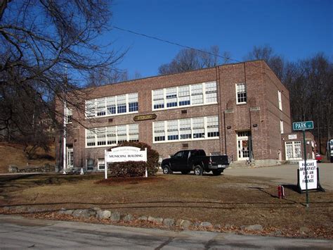
Board of Health
Municipal Building
1 Park Street
Sterling, MA 01564
and
Kathleen Farrell, Town Clerk
Municipal Building
1 Park Street
Sterling, MA 01564
RE: Public Records Request in Accordance With Mass.Gen.Laws Ch. 66, Sec.10
Ladies and Gentlemen,
  In accordance with Mass.Gen.Laws Ch. 66, Sec.10, request is hereby made for copies of any and all completed Soil Percolation Test Form(s) 12, for each spot/location on Sterling Assessors' Parcel  92-108, 9 Redstone Hill Road, westerly of James Patten Drive, now assessed to J.E. Simpson Excavating, Inc., that soil percolation tests were performed at any and all times whatsoever, and for copies of any and all Soil Suitability Assessment for On-Site Sewage Disposal Form(s) 11, concerning that Parcel 92-108, completed at any and all times whatsoever. Please advise me of the costs for producing and mailing to me those copies.
 Failure to respond to this request in a timely manner may result in a Superior Court enforcement action.
NOTE: A “coldwater fishery” headwaters tributary stream protected by 321 CMR 5.00 et seq. flows through that Parcel 92-108 and eventually joins another headwaters tributary stream on the easterly side of Clinton Road (Route 62) to form the Wekepeke Brook, South Branch, a “coldwater fishery,” near the Hillside Cemetery property. The protected headwaters tributary stream that flows through Parcel 92-108 begins at a wetland on Kendall Hill southerly of Kendall Hill Road, flows under Kendall Hill Road northerly by Abbey Lane, thence northerly across Clearview Farm and under Maple Street to a swamp/wetland on the westerly side of Ashton Lane, thence northerly under Ashton Lane to a wetland on Parcel 36, thence through Parcel 35 to said Parcel 92-108, thence under Redstone Hill Road downhill to join the other tributary stream referred to on the easterly side of Clinton Road. The Wekepeke Brook, South Branch, then flows westerly under Clinton Road, then northerly by Route 12. There are native brook trout in it…
 I thank you for your anticipated cooperation.

                                                                                                      Sincerely,


                                                                                                      James F. Gettens, Esq.
cc:
Adam Kautza, Coldwater Fishery Project Leader, Mass.Wildlife
Marielle Stone, Deputy Regional Director, Mass.DEP
Town of Sterling Conservation Commission
Town of Sterling Building Commissioner
BOARD OF HEALTH RESPONSE
Under cover letter dated 19 July 2021 the Sterling Board of Health produced hand-printed notes on three sheets indicating that on December 8, 2020 soil percolation tests were attempted on Simpson’s parcel but the effort was “cancelled, soil too wet/moist.” Instead, “deeps” were done in what was described as “sandy loam” and “loamy sand.” On “lot 1” “weeping” occurred at 50, 60, and 80 inch depth levels at various spots chosen for “deeps” testing. On “lot 2” “standing water” was found at 42, 46, 48, and 70 inch depth levels at the various spots chosen for “deeps” testing. The Board of Health did not produce any completed Forms 11 or 12 in response to my request.
Simpson submitted another Application to “Perform Soil Testing Observations” on 22 July 2021. Therefore, I will submit yet another Public Records Request for the pertinent documents.
WHERE ON THE PARCEL IS THAT “SANDY LOAM” AND “LOAMY SAND”???
The Sterling Geological Features Map shows that westerly and uphill from the tributary stream referred to is “Abundant Outcrop and Shallow Bedrock”– https://www.sterling-ma.gov/sites/g/files/vyhlif1266/f/file/file/part16.pdf If you want to see how rocky that Kendall Hill spur is just go to Chocksett Burial Ground and examine the hillside above it. That hillside was selectively cut/logged in the past year or so. SO, where on that Simpson parcel is the “sandy loam” and “loamy sand” referred to in the hand-printed notes produced by the Sterling Board of Health??? Probably in or near the “Wetlands Protection” “buffer zone” that is supposed to protect from disturbance the tributary stream referred to.
SOME STERLING JOKES
Old joke: “The Simpsons never bought a wetland that didn’t perc.”
New joke: “The Simpsons never bought ledge rock that didn’t perc.”
Established joke: “Sterling has the best Town Government money can buy.”
WATCHING THE STERLING CONSERVATION COMMISSION ON THIS IMPENDING DEVELOPMENT
Stay tuned! Let’s observe to what extent our intrepid Sterling Conservation Commission members go to protect the Wekepeke Brook, South Branch, tributary stream on Simpson’s parcel. The only access to that parcel from James Patten Drive is over and across that tributary streambed. In addition, let’s see if the purported trout-lovers running the Sterling Land Trust speak up about protecting that headwaters tributary stream.
J.G.
P.S. Apologies for the involuntary font changes that I was unable to correct.
